MAXML
Key Features
Transparency and Compatibility
- MAXML is a public XML format
- Backward and forward compatible
Variety of Data Types
Data types for any applied area:
- Raw Optical and GNSS Measurement
- Civil Engineering Design and Survey
- Design
- Reporting and Management
Data Exchange with 3rd Parties
The easiest way to exchange complex surveying and construction data with 3rd parties
MAXML Samples
Sample files and rendered screenshots
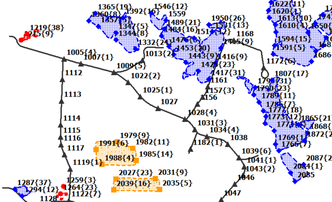
Geodesy/Surveying/GIS
Project in SPC83 coordinates, containing 1092 points, 11 lineworks and 26 areas, using 4 codes and grouped in 5 layers.
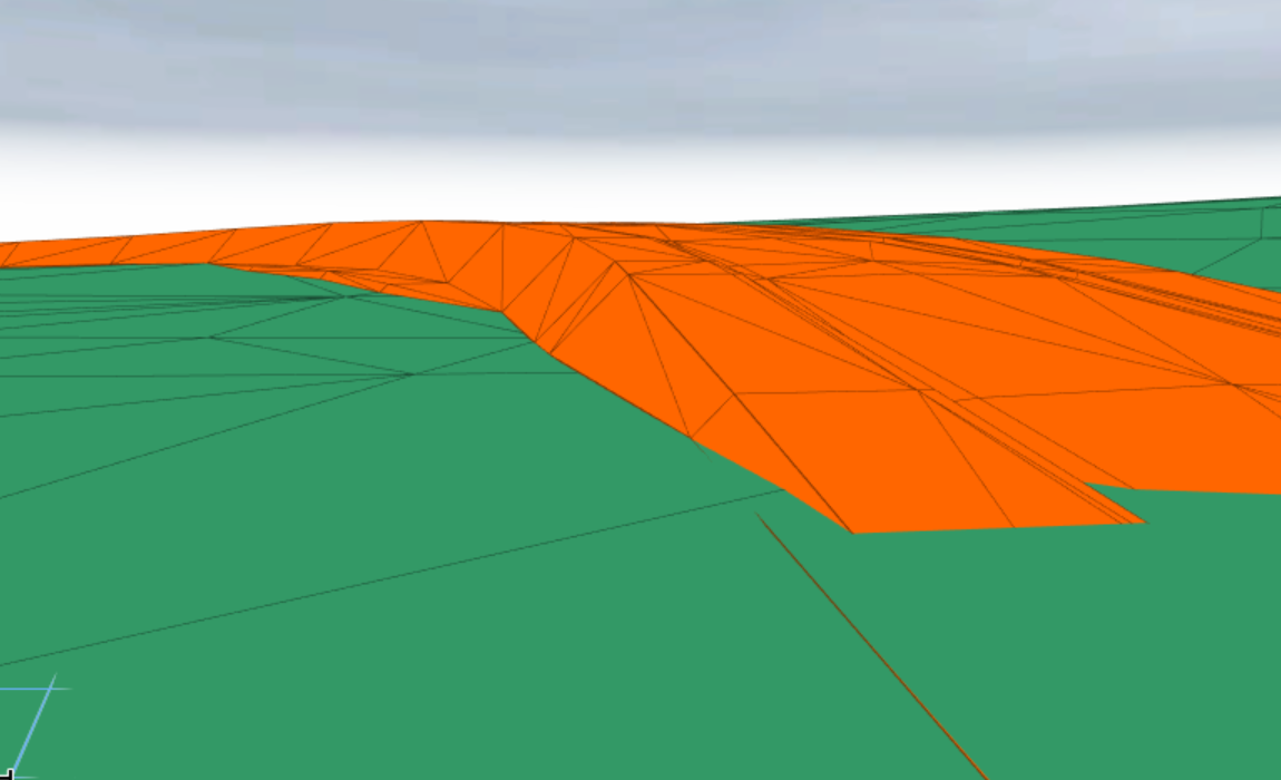
Horizontal construction
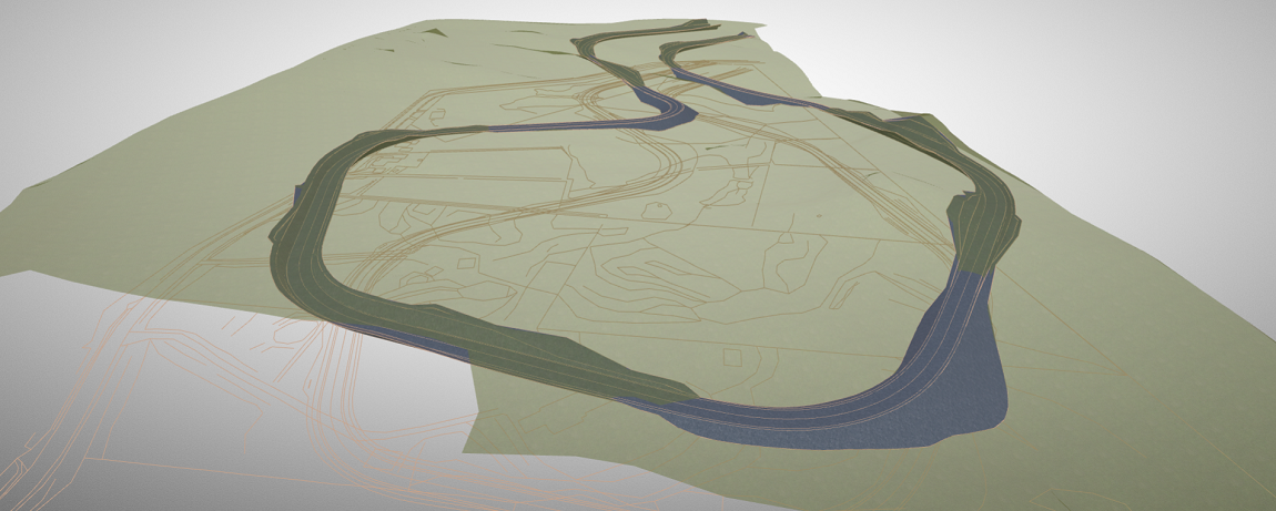
Project in MGA94 coordinates, containing 3 surfaces and one road with 64 cross sections.
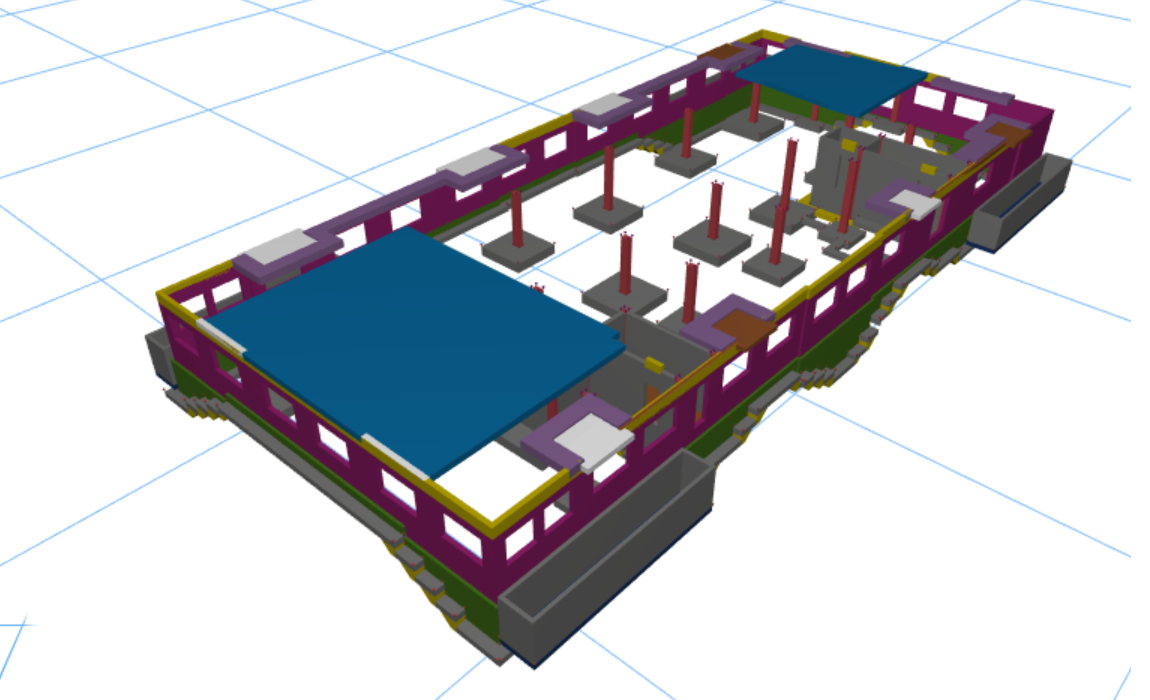
Vertical construction
Project in local coordinates, containing one 3d model with 1188 elements
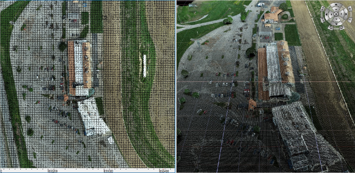
Point clouds
Project in local coordinates, containing 1 point cloud with 5 million points.
Textures
Project in ground coordinates, containing one surface and one road with 220 cross sections.
Recent Releases
MAXML 1.9
Corresponds to Topcon Software Platform 11.x and corresponding Software Products Family
MAXML 1.8
Corresponds to Topcon Software Platform 10.x and corresponding Software Products Family
MAXML 1.7
Corresponds to Topcon Software Platform 9.x and corresponding Software Products Family
MAXML 1.6
Corresponds to MAGNET 8.x Software Products Family
New data types supported (since MAXML 1.5):
- Point Clouds
- Raw data for Digital Level
- ogcWktCode reference for coordinate system
MAXML 1.5
Corresponds to MAGNET 7.x Software Products Family
New data types supported (since MAXML 1.4):
- Custom Symbols support
- Custom Line style
- Custom Area fill pattern
- Raw data Prism Information
- Material data extended
- NTRIP mountpoint data
- RTCM CT definition
MAXML 1.4
Corresponds to MAGNET 6.x Software Products Family
- Complete definition of coordinate systems
- Design Data: Points, Linework, Areas, Surfaces, Background Images, Layers and Codes, Plane
- Civil Engineering Design and Survey Data: Multiple Coordinates Systems, Localization and Grid2Ground parameters, EPSG code referencing, Road Design (X-Section sets, String sets, Alignments, Station equations), SurveyXSections
- Reporting and Management: Tasks & Material volumes, Field Reports, Stakeout Reports
- BIMProjects (3D models)
- Raw Survey Data: Raw GNSS measurement data, Raw Optical measurement data